
Trace a Clark County Street
Use the same address form through the chain. The Clark County Assessor supplies the current parcel lead, not proof that every person connected with the parcel lives there. The Recorder supplies the recorded-instrument trail, not a street-address roster. Election records have their own access limits, and a historical directory is only evidence for the edition date. Keeping those distinctions clear makes a street-by-street search more reliable and reduces false matches caused by a unit number, a directional prefix, or a duplicate street name.
- Search the full address in the Assessor's real-property records. Record the APN, situs address, owner or vesting field, legal description, and any map or sales link.
- Open the same APN in AssessorMap. Compare parcel, lotline, easement, and nearby-parcel layers, while treating the map as an assessment aid rather than a survey.
- Use the owner name, APN, instrument number, and legal description in the Recorder index. Confirm the party role and document type before ordering a copy.
- For an election-record lead, consult the County's voter-list files or official walking-list route only under its stated access conditions. Registration fields are not proof of current physical presence.
- For an older household clue, compare the address with a dated street directory, map, newspaper, or the UNLV address indexes, then corroborate it with a deed, permit, or census source.
That sequence moves from an address to the current owner field, then through the deed chain, an election-record lead, and a dated directory source. It also keeps an APN and legal description available when a street name or number has changed.
Note: Preserve the typed address and the matched official form, because a unit, directional, or street-type difference can change the result.
Clark County Address Normalization
Split an address into number, directional, street name, street type, unit, city, state, and ZIP before searching. The county's Composite ZIP geocoder can return a candidate score, matched address, type, city, county, state, ZIP, and coordinates. That makes it useful for comparing a typed address with a standardized candidate. It does not prove occupancy or decide which city government has jurisdiction.
Clark County includes incorporated cities, unincorporated communities, and rural areas. A postal city, assessor situs, ZIP polygon, planning area, and municipal boundary can differ. Use the parcel and GIS boundary layers to identify the agency that keeps a permit, street-naming, or city record. For a proposed street-name or numbering change, Comprehensive Planning provides a Street Name or Numbering System Change appointment route.
Clark County Street Property Search
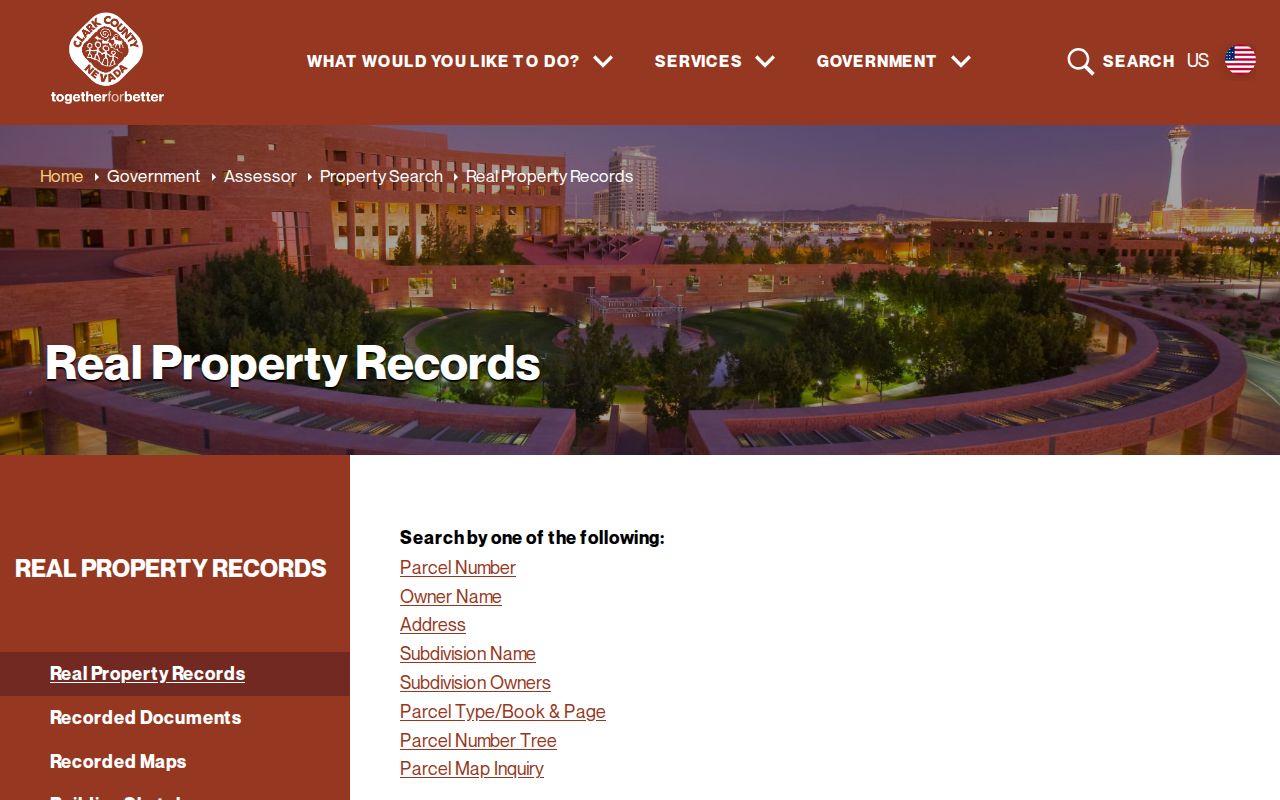
The Clark County Assessor's Real Property Records route is the best first stop for a current address lead. It offers parcel number, owner name, address, subdivision name, subdivision-owner, parcel type or book-page, parcel tree, and parcel-map inquiry routes. Record both the situs and mailing fields when shown. The mailing field is a tax-contact field and may not be the physical parcel location.
The official real-property records page shows the available search paths before a live parcel is selected.
Use the result as a parcel card, not a statement of occupancy. Its APN, legal description, map, sketch, sales, and title-transaction links are the bridge to recorded documents and map layers.
| Clark County search field | Input type | How it helps a street search |
|---|---|---|
| Parcel number or APN | Text | Connects an address lead to a stable parcel identifier. |
| Owner name | Text | Provides a vesting lead for Recorder index searches. |
| Address | Text | Starts with the current situs form and exposes formatting differences. |
| Subdivision and owners | Text routes | Helps when lot, block, or subdivision language appears in a deed. |
| Parcel tree or map inquiry | Action route | Helps track parcel relationships that may matter after a split or merger. |
Note: Assessor maps support assessment research; recorded maps and instruments control when the legal detail matters.
Clark County Street Parcel Layers
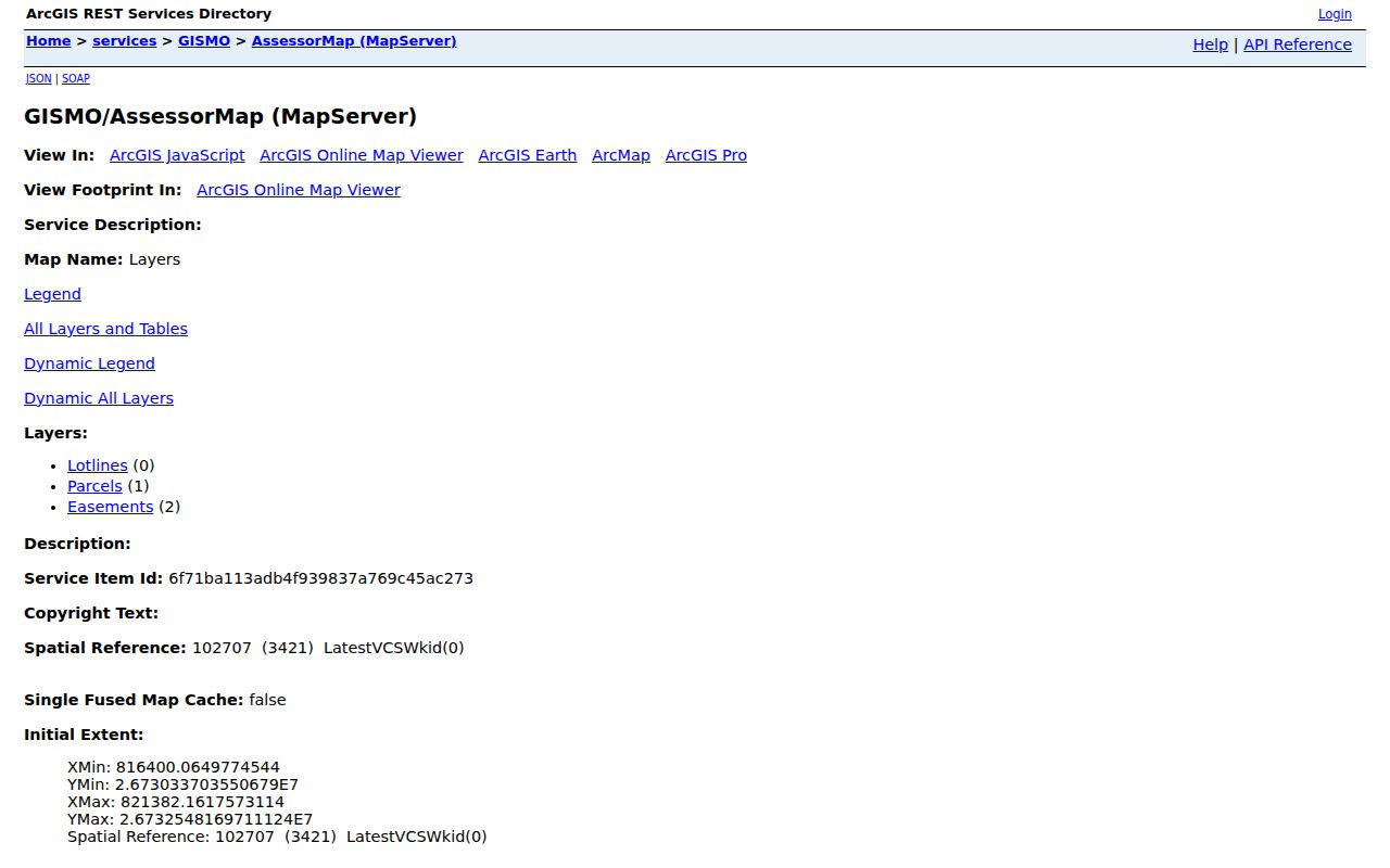
AssessorMap exposes lotline, parcel, and easement layers with query, identify, find, map, and export operations. It is useful for seeing whether an address lead sits beside another parcel or within a recorded subdivision pattern. The service displays a maximum record count of 10,000, another reason to narrow a street search rather than treating a broad map result as complete.
The County's AssessorMap parcel service documents the layers and operations available for Clark County address research.
The map can reveal an APN relationship or easement lead, but a generalized parcel display is not a legal boundary survey. Use the recorded parcel or subdivision map and the deed when a boundary or title question depends on precision.
Clark County Deeds Along a Street
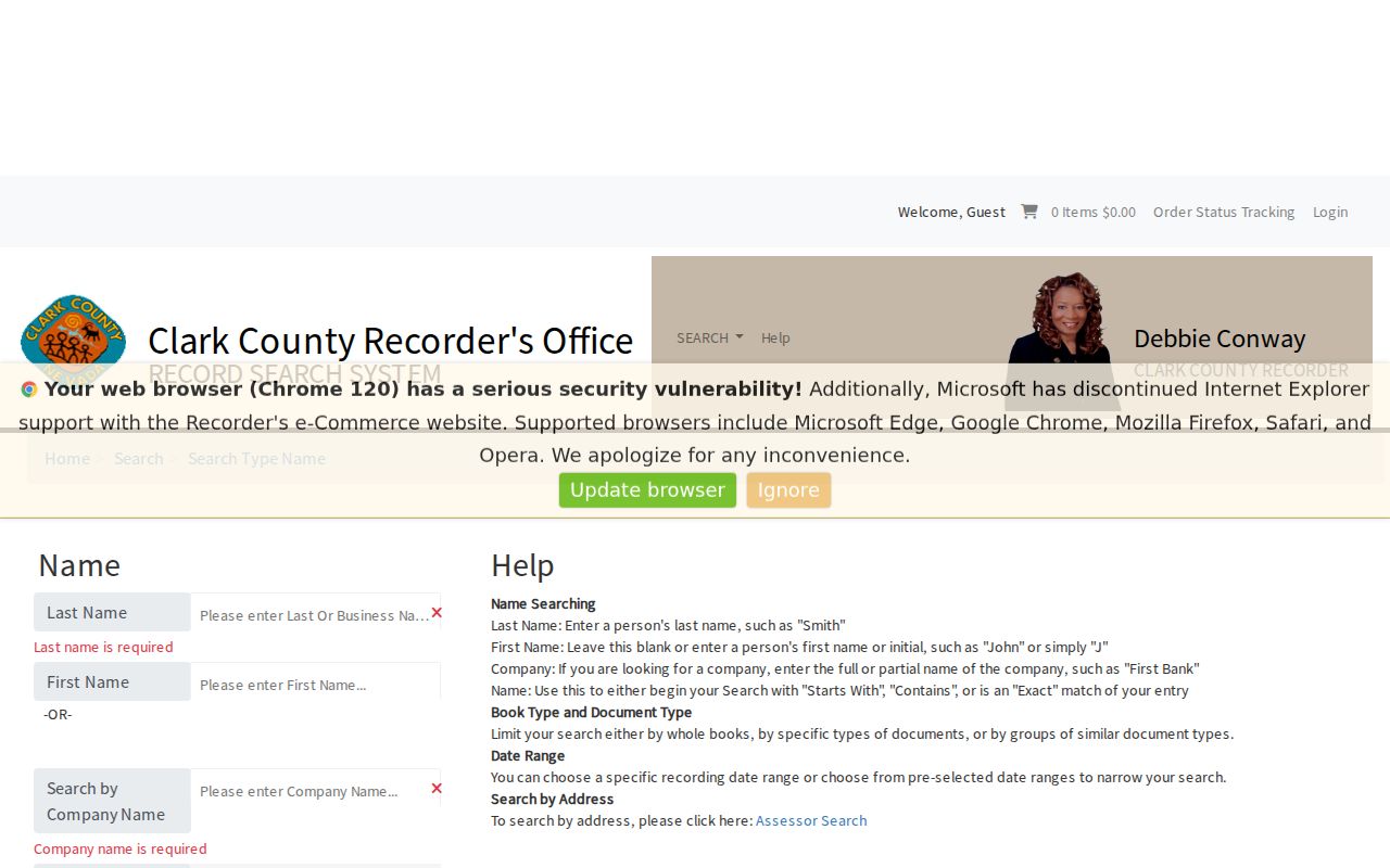
The Clark County Recorder official-records index can be searched by name, parcel number, instrument number, document type, book or page, record date, total value, and legal description. In name search, last name or company is required, first name is optional, and match logic can be starts, contains, or exact. Combine the current parcel's APN with party names instead of expecting a street-only archive.
The Recorder name-index screen shows the filters used to narrow a Clark County street directory deed search.
Index entries are a lead. The Recorder says originals are not generally available as public website images. After confirming the instrument, a copy can be ordered online, by mail using the official request form, or in person. Online copies are listed at $1 per page plus $4 for certification, with a 2 percent total fee and a $1.25 online charge. Email PDFs generally take 1-2 business days; domestic paper delivery is generally 7-10 business days.
- Parcel or APN
- The assessor's identifier for a parcel. It helps join current map and assessment research to recorded-document searches.
- Situs address
- The parcel's physical-location field. It should not be treated as the same thing as a mailing address.
- Plat or recorded map
- A recorded map that can establish subdivision, lot, block, or other legal-description context more precisely than a display layer.
- Criss-cross directory
- An address-sequence directory that can offer a dated occupant clue, rather than a current ownership determination.
Clark County Permits by Address
Permit records can add an improvement or project chronology to a Clark County street search. The County's building document image search accepts record number, parcel, location, and document-type filters. Citizen Access supports address, parcel, owner, record-information, permit, project, department, and other search routes. Search both systems because the legacy and current records do not have the same coverage.
Citizen Access defaults to the last five years and may expose additional history, status, or invoices to an account holder. The legacy collection can have missing documents, and some copyrighted plans are available only at the office. A permit can document an event at a place; it does not establish a household roster.
Note: Match a permit by APN, date, project description, and jurisdiction before connecting it to a deed or directory clue.
Clark County Street Directory Records
Each address-keyed source answers a different question. A careful Clark County street directory comparison starts with the property record and then uses maps, instruments, permits, election files, and dated historical sources only for the role each source can support. The table separates current parcel facts from historical or registration leads.
| Address-keyed source | Clark County keeper | What it can show | Access route |
|---|---|---|---|
| Assessor parcel record | Clark County Assessor | APN, owner or vesting, situs, mailing field, legal description, map and sales leads | Public property-search route |
| Parcel and easement layers | GIS Management Office | Approximate parcel, lotline, and easement relationships | AssessorMap query and identify service |
| Recorded instruments | Clark County Recorder | Party roles, document type, record date, APN, legal description, and copy route | Public index; copies online, mail, or in person |
| Permit records | County Building and Fire Prevention | Record, parcel, location, document type, and project history leads | Legacy images and Citizen Access |
| Election data | Clark County Elections | Dated registration and district fields when publicly released | Weekly files and walking-list route, subject to restrictions |
Ownership is not occupancy, and a voter file is not a census. If a current address record and a historical source conflict, preserve the source date and role instead of forcing them into one story.
Clark County Historic Street Clues
Clark County street research often crosses eras. The 1905 Las Vegas townsite grid, later subdivision maps, and the modern parcel system explain why an old address may need a legal description, lot and block, or map before it can be connected with its current form. The UNLV Jack K. Leavitt Collection holds 31 Las Vegas and Henderson homeowner, address, street-sequence, map, ownership, and parcel-number indexes from 1968-1981, with most material from 1973-1981.
UNLV also identifies a 1975 Las Vegas Valley street directory and Las Vegas maps and guides from 1975-1981. The Library District's genealogy resources add directories, census material, newspapers, and obituary resources under their own access rules. Historical volumes are described more fully in the Clark County city directory collection guide; use a dated entry as a clue and confirm it with a recorded document, permit, map, or newspaper.
Clark County Street Jurisdiction Checks
Before asking for a local permit, city map, or municipal record, confirm whether the parcel falls in Las Vegas, Henderson, North Las Vegas, Boulder City, Mesquite, unincorporated Clark County, or a rural community. Those places use separate city or county systems. A Las Vegas postal address alone does not place a parcel inside the City of Las Vegas.
GIS overlays can add ZIP, city, unincorporated-town, school, precinct, district, and TAB or CAC context. They are useful for routing a request, not for establishing title or private membership. The free county GIS maps and the dated ZIP-boundary map are better starting points than a mailing-city assumption.
The Assessor search page also links to a road-document listing. That route requires an 11-digit parcel number or recorded document number, and road maps can take about two minutes to load in a PDF reader. It can supply a useful recorded-map lead, but it does not replace the deed or the responsible city's street record.
Note: A parcel split or merger can change the current APN, so follow recorded legal descriptions and subdivision references backward.
Clark County Street Privacy Limits
A Clark County street directory cannot safely show every person connected with an address. Assessor owner or mailing fields do not prove present occupancy. GIS is not a boundary survey, Recorder entries identify recorded roles rather than residence, and voter files omit confidential fields. Nevada's Confidential Address Program uses substitute addresses for eligible participants, and protected recorder information may also be withheld.
Nevada's NRS Chapter 239 generally opens nonconfidential public records during office hours, but the actual custodian decides what is available and what must be redacted. Ask for a nonexempt portion and the legal basis for a withholding when needed.
Lawful use. Use Clark County address records for personal, lawful research such as family history, estate work, or property questions. Do not use them to stalk, harass, intimidate, or expose protected information about anyone.